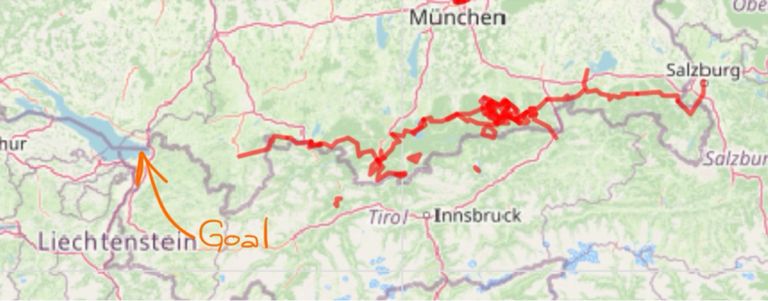
Bavarian alps traverse#

https://maxcodebox.github.io/biketours/bavarian-alp-traverse.html
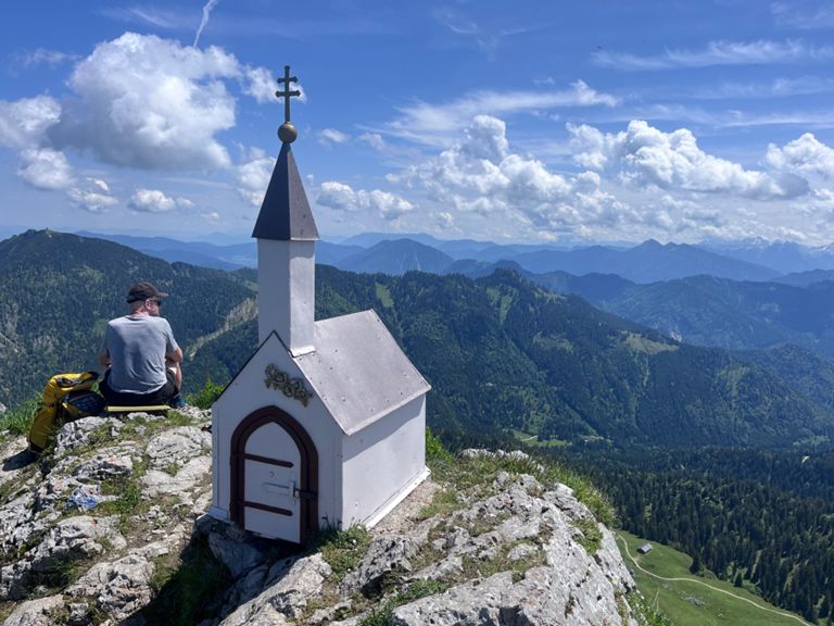
⛰️ Berchtesgadener Hochthron (1,972 m) • ⛰️ Hochalpkopf (1,886 m) • ⛰️ Großer Heubergkopf (1,820 m) • ⛰️ Salzburger Hochthron (1,853 m) • ⛰️ Geiereck (1,805 m) | 🌐 summitbag.com
⛰️ Fuderheustein (1,321 m) • ⛰️ Hochstaufen (1,771 m) • ⛰️ Mittelstaufen (1,657 m) • ⛰️ Hendelbergskopf (1,613 m) • ⛰️ Zennokopf (1,756 m) • ⛰️ Zwiesel (1,782 m) • ⛰️ Gamsknogel (1,750 m) • ⛰️ Zellerberg Hauptgipfel (1,065 m) • ⛰️ Zellerberg Nordgipfel (992 m) | 🌐 summitbag.com
⛰️ Roßkopf (1,156 m) • ⛰️ Hochgern (1,748 m) • ⛰️ Thoraukopf (1,481 m) • ⛰️ Hochfelln (1,674 m) | 🌐 summitbag.com
⛰️ Hammerstein (1,278 m) • ⛰️ Zellerhorn (1,360 m) • ⛰️ Jagerwand (1,396 m) • ⛰️ Zellerwand (1,415 m) • ⛰️ Hochries (1,569 m) • ⛰️ Karkopf (1,496 m) • ⛰️ Pölcher Schneid (1,390 m) | 🌐 summitbag.com
⛰️ Kaserwand (1,690 m) • ⛰️ Wildalpjoch (1,720 m) • ⛰️ Seewandköpfl (1,664 m) • ⛰️ Lacherspitz (1,724 m) • ⛰️ Kesselwand (1,721 m) • ⛰️ Soinwand (1,756 m) • ⛰️ Zeller Scharte (1,611 m) • ⛰️ Wendelstein (1,838 m) | 🌐 summitbag.com
⛰️ Sebaldstein (1,733 m) • ⛰️ Taubenstein (1,692 m) • ⛰️ Taubensteinsattel (1,580 m) | 🌐 summitbag

⛰️ Brecherspitz Vorgipfel (1,643 m) • ⛰️ Brecherspitz (1,685 m) • ⛰️ Spitzingsattel (1,130 m) | 🌐 summitbag.com
⛰️ Grasleitenstein (1,268 m) • ⛰️ Grasleitenkopf (1,433 m) • ⛰️ Seekarkreuz (1,601 m) • ⛰️ Grubereck (1,664 m) • ⛰️ Risserkogel (1,826 m) • ⛰️ Bodenschneid (1,669 m) | 🌐 summitbag.com
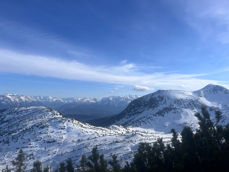
⛰️ Stangeneck (1,646 m) • ⛰️ Vorderer Kirchstein (1,670 m) • ⛰️ Latschenkopf (1,712 m) • ⛰️ Achselköpfe (1,709 m) • ⛰️ Rotöhrsattel (1,665 m) • ⛰️ Benediktenwand (1,800 m) • ⛰️ Glaswandscharte (1,324 m) • ⛰️ Pessenbacher Schneid (1,270 m) | 🌐 summitbag.com
This run: 2330hm/36.46km=63.9hm/km Val d’Aran: 10000hm/161km=62.1hm/km
So I just need to do this path 4.4 times
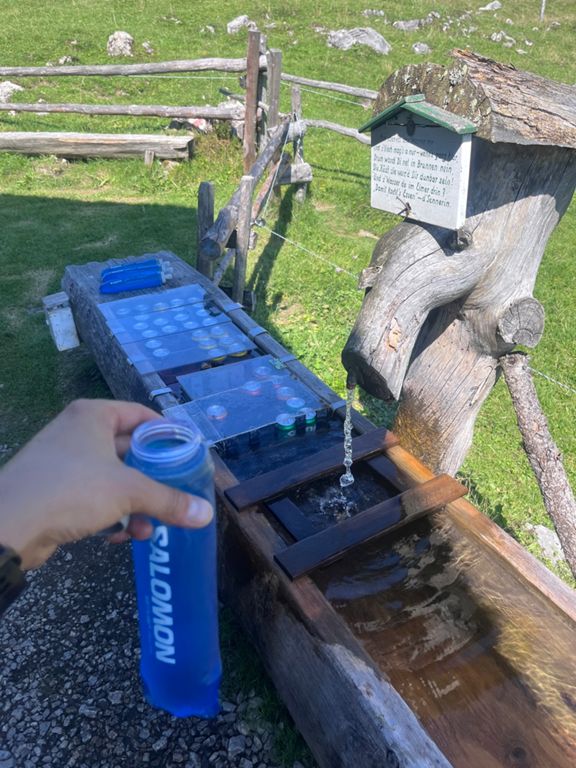
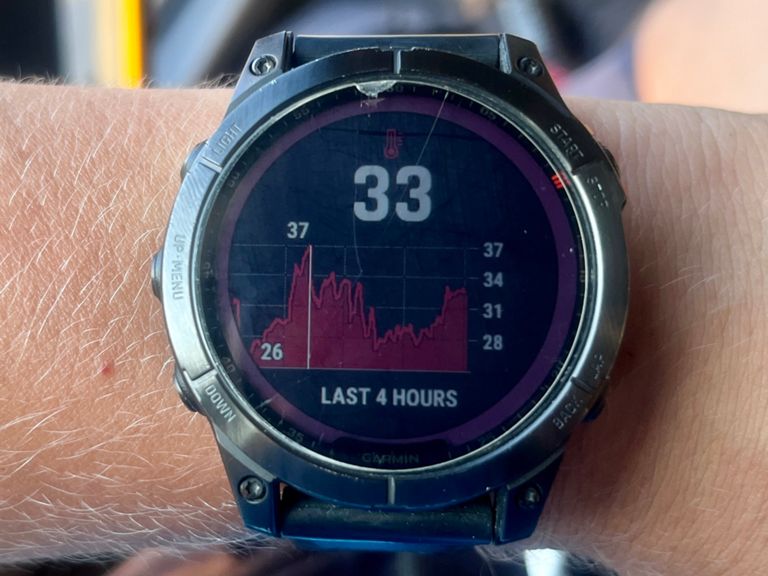
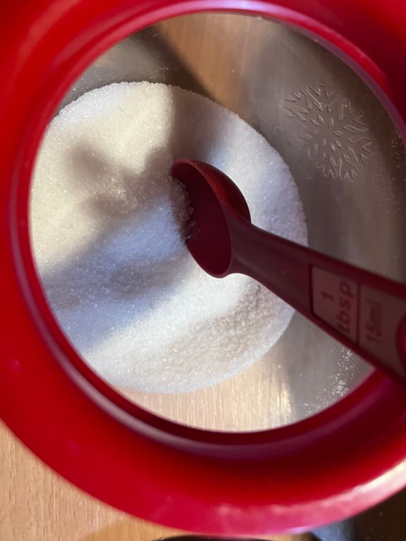
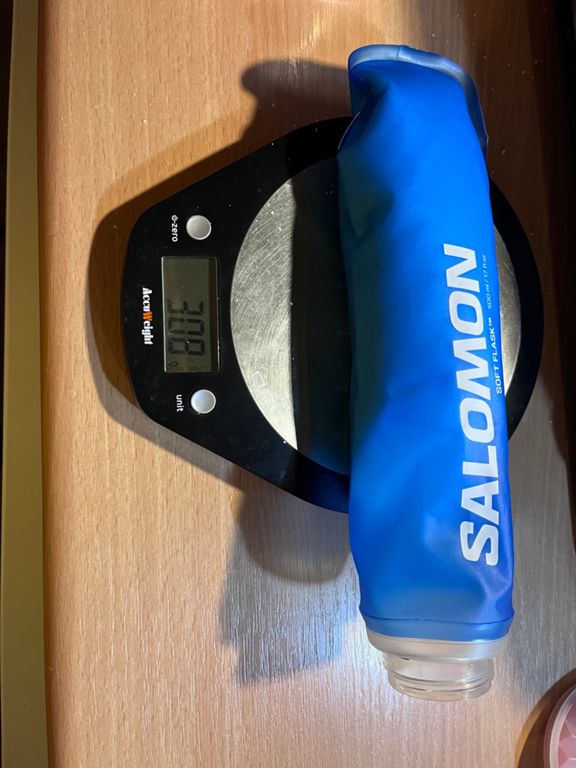
Fuel: 2x200g of sugar in 2x500ml water, plus 1.5 water water on my back. Filled up one soft flask once, would have needed more water.
⛰️ Kienstein (968 m) • ⛰️ Sonnenspitz (1,269 m) • ⛰️ Jochberg (1,565 m) • ⛰️ Kesselberg (858 m) • ⛰️ Martinskopf (1,676 m) • ⛰️ Herzogstand (1,731 m) • ⛰️ Heimgarten (1,791 m) | 🌐 summitbag.com
⛰️ Hohe Kisten (1,922 m) • ⛰️ Wank (1,780 m) | 🌐 summitbag.com
⛰️ Bürstling (1,466 m) • ⛰️ Sorgschrofen (1,636 m) • ⛰️ Zinken (1,613 m) • ⛰️ Jochschrofen (1,625 m) • ⛰️ Steinpasssattel (1,557 m) • ⛰️ Hirschberg (1,644 m) • ⛰️ Spieser (1,651 m) • ⛰️ Tiefenbacher Eck (1,527 m) | 🌐 summitbag.com
⛰️ Steineberg Vorgipfel (1,660 m) • ⛰️ Steineberg (1,683 m) • ⛰️ Steinköpfle (1,665 m) • ⛰️ Stuiben (1,749 m) • ⛰️ Auf dem Sattel (1,677 m) • ⛰️ Sedererstuiben (1,737 m) • ⛰️ Gatterscharte (1,575 m) • ⛰️ Buralpkopf (1,772 m) • ⛰️ Gündleskopf (1,748 m) • ⛰️ Gündlesscharte (1,543 m) • ⛰️ Rindalphorn (1,821 m) • ⛰️ Gelchenwanger Kopf (1,812 m) • ⛰️ Brunnenauscharte (1,628 m) • ⛰️ Hochgrat (1,834 m) • ⛰️ Seelekopf (1,663 m) | 🌐 summitbag.com
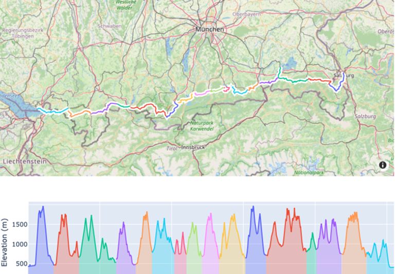
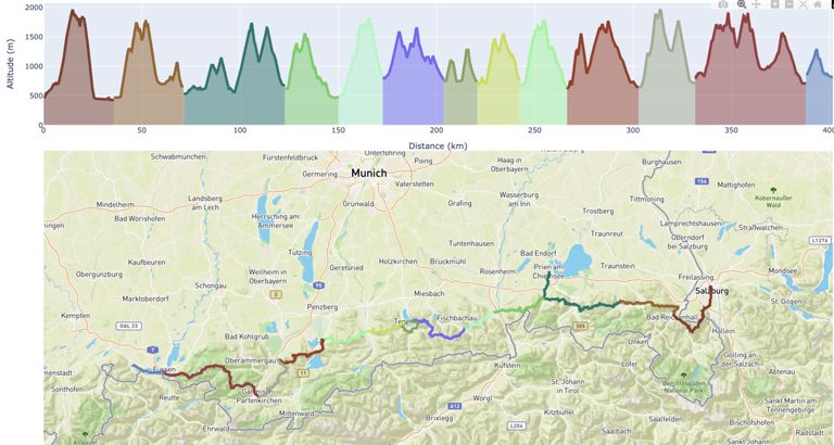
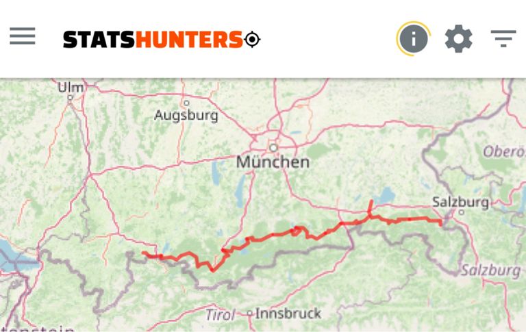
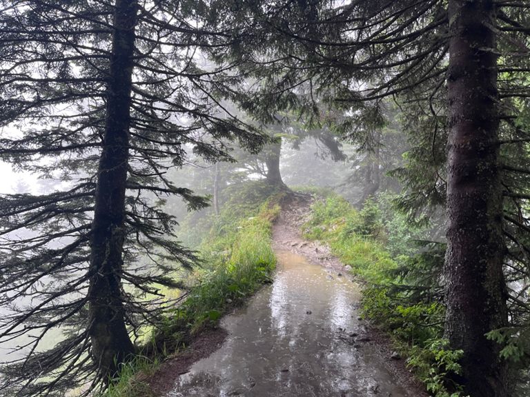
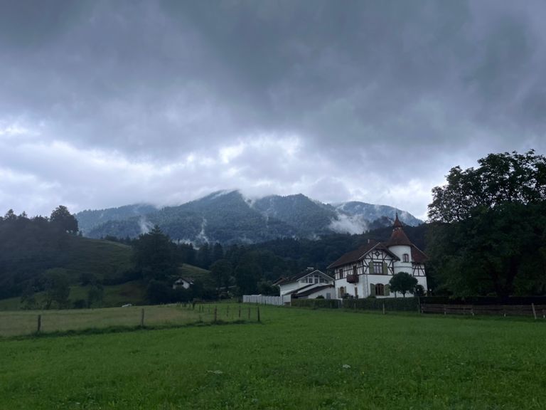
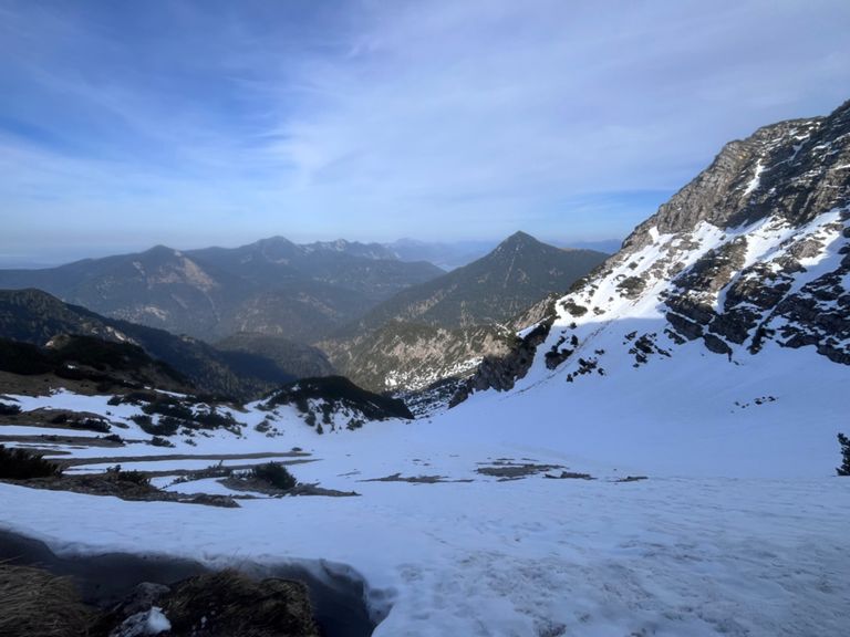
Bad Reichenhall to Salzburg 🏃⛰️, distance: 35.7 km, elevation gain: 1997 m Bad Reichenhall to Ruhpolding 🏃⛰️, distance: 35.6 km, elevation gain: 2463 m Prien am Chiemsee to Ruhpolding 🏃⛰️, distance: 51.5 km, elevation gain: 2723 m Aschau to Brannenburg 🏃⛰️, distance: 27.5 km, elevation gain: 1429 m Brannenburg to Bayerischzell 🏃⛰️, distance: 22.4 km, elevation gain: 1833 m To Tegernsee 🏃⛰️, distance: 31.2 km, elevation gain: 1638 m Halfway around Tegernsee 🏃⛰️, distance: 17.1 km, elevation gain: 1049 m Romantic walk through the mountains 🏃⛰️, distance: 21.5 km, elevation gain: 1298 m Lenggries to Kochel 🏃⛰️, distance: 24.0 km, elevation gain: 1611 m Kochel to Eschenlohe 🏃⛰️, distance: 36.5 km, elevation gain: 2330 m Snowy hike to Garmisch 🏃⛰️, distance: 28.7 km, elevation gain: 2050 m Füssen to Garmisch 🏃⛰️🇩🇪, distance: 56.4 km, elevation gain: 3156 m Pfronten to Füssen 🏃⛰️🇩🇪🇦🇹, distance: 13.7 km, elevation gain: 541 m Pfronten to Sonthofen 🏃⛰️, distance: 35.1 km, elevation gain: 2121 m Sonthofen to Oberstaufen 🏃⛰️, distance: 35.3 km, elevation gain: 2297 m Finish of the Bavarian alps traverse! 🏃⛰️, distance: 38.9 km, elevation gain: 1278 m
⛰️ Hirschberg (1,095 m) | 🌐 summitbag.com